Instrumentation
The Perdigão project were instrumented with several tall Met-Masts and multiple remote sensing devices. A list of instruments and their locations is shown below.
Tower Instrumentation
Tall Met-Masts used in Perdigão during the observational period is described below:
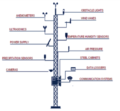 Example of generic sensor, datalogger and communications system locations on a typical instrumented meteorological tower. The sensor suite and sensor height (including multiple levels on tall towers) is not shown in detail here.
The 52 meteorological towers, apart from the sequential numbering:
- 1 to 16: North-west transect
- 17 to 31: South-east transect
- 32 to 39: South West ridge
- 40 to 46: North-east ridge
- 47 to 53: valley
- 54 & 55: extreme (outside the central region)
As of 1 May 2017, the start of the IOP, 81% of the towers are operational and transmitting data. The progress can be tracked on the Tower Status Update spreadsheet. The typical layout of the tower instruments and communications system is shown in Figure below.
For a complete listing of the towers visit https://perdigao.fe.up.pt/stations
Remote Sensing Instrumentation
Remote Sensing equipment used in Perdigão during the observational period is described below:
The Perdigão project's observational period was from May 1, 2017 to June 15, 2017.
- 30 Scanning Doppler Lidar
- 2 Sodar-Rass
- 2 Radar Wind Profilers
- Collaborative Lower Atmospheric Mobile Profiling System (CLAMPS)
- 2 Tethered Lifting System (TLS)
- Radiosondes (every 6 hours)
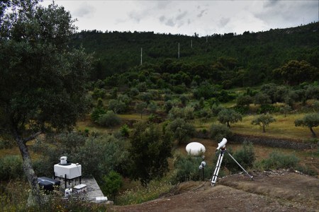 ARL Scanning Doppler Lidar, TLS, 5 Towers & Scintellometer at Site George
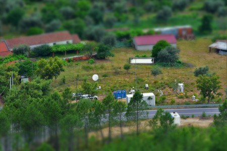 Multiple Remote Sensing Devices at Site Orange
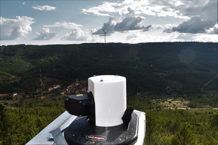 Notre-Dame Scanning Doppler Lidar at Site LionsHead
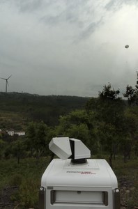 DLR Scanning Doppler Lidar